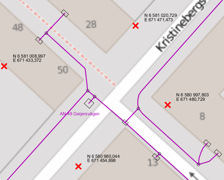
The function places points in the form of red crosses in the map that show the coordinates of that particular point (coordinate texts), in the view's current coordinate system.
|
The crosses and coordinate texts remain only during the current session. |
Place coordinates for point
1.Select Place > Coordinates for point.
2.Place the cross on the map freely, where you want to see the coordinates, or snap to the vertices of existing components.
3.A coordinate text is placed diagonally above to the right of the cross.
4.The function will be activated until another function is selected.
More information
|
•If there is a ground elevation model configured, N (North), E (East) and H (Height) will be placed in the map •If there is no unconfigured ground elevation model, N and E will be placed in the map •The function also works with the Free plotting tool. |
|
The cross and the coordinate texts can be removed by pressing Refresh or F5. |
Example
Example of how the coordinate text can look in the map view: