A buffer zone is an area of a given width that surrounds an object in the map. Buffer zones are useful for e.g. distance analysis.
It is possible to create a temporary buffer zone of a given size in meters around pipes, roads, buildings, nodes or other types of graphics in the map.
It is possible to create a buffer zone around arbitrary points by either using the alternative Place on object or Free placement.
Buffer zones is temporary graphics, which means that you cannot save buffer zones. (Hint: To save a buffer zone in the form of an object, you can create a free postable polygon where you copy the buffer zone by selecting Copy existing geometry.)
Create buffer zone
1.Select Tools > Buffer zone:
2.Select one of the alternatives Place on object or Free placement.
3.Select one of the predefined buffer zone sizes or select Specify size... to set your own specific buffer zone size.
4.Select one or more objects in the graphical view. A buffer zone is generated around the selected objects.
5.Press F5 to remove the buffer zones (refresh graphics).
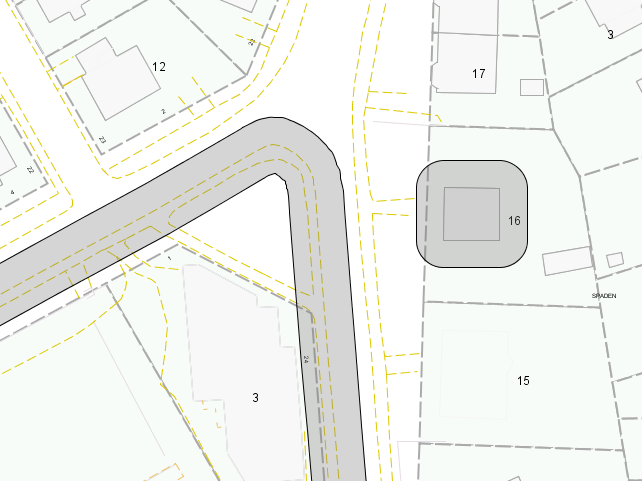
Here, buffer zones with a size of 4.5 meters have been drawn around a roadside and around the building on the right.
More information
|
It is possible to edit the graphics of a buffer zone, for example, its fill and border colors. The graphical components of buffer zones are contained in the product class Special components in the geographical map(s). Find out more about how to edit map graphics in section Adjusting Themes, Maps and Graphics. |